The Pre-Processed US Property Database Built for Underwriting.
Roof condition, building details, and wildfire and flood exposure for US properties, drawn from imagery and ready for quoting, renewal, and portfolio review
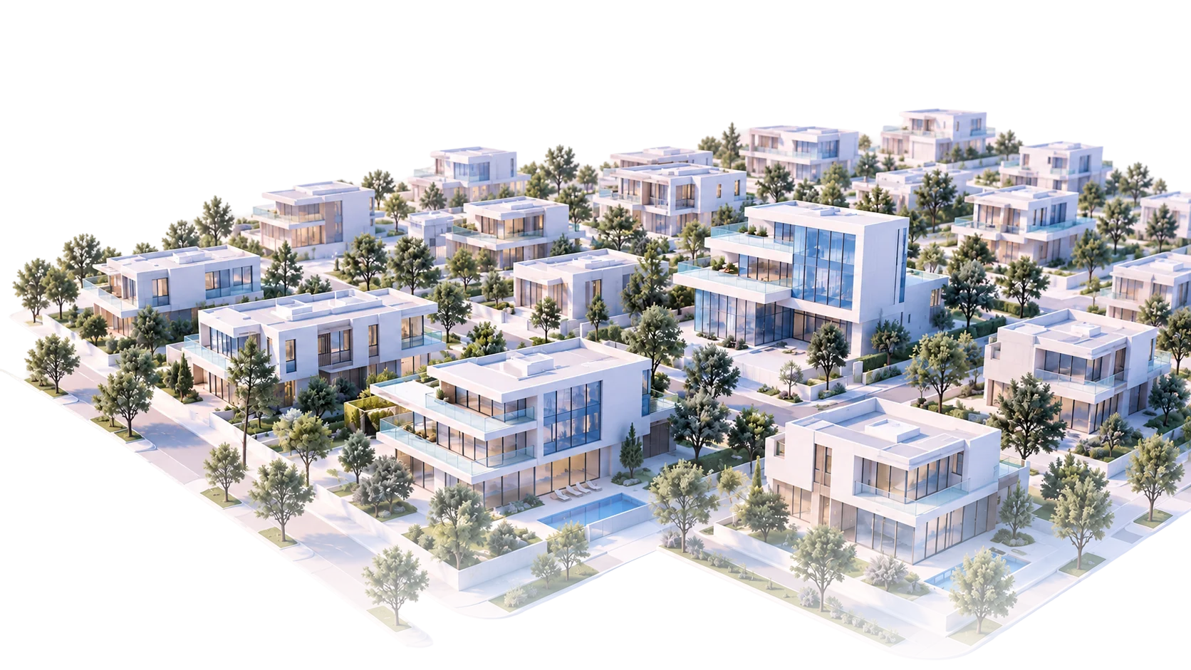
-
186.2 M
US Properties
-
64+
Attributes
-
97%
Nationwide Coverage
-
<1 sec
API Response
-
Quarterly
Refresh Cycle
The "no data available" problem costs carriers millions every year.
When an underwriter can't see the property, they either decline the risk, underprice it, or send an inspector. All three options cost money.
Incomplete property data means blind spots in your book. Rural properties go unassessed. Roof conditions go unverified. Vegetation risk goes unmeasured. And every gap is a potential loss waiting to happen.

Every US property.
Already processed. Ready to use.
-
Nationwide
Commercial and residential properties across all 50 states, with coverage designed to reach beyond the areas incumbents serve best.
-
Pre-processed
Every property is processed in advance, rather than captured and processed per request.
-
Ready
The USDB provides pre-processed property intelligence whenever your team needs it.
-
Instant
Your team gets answers in under a second, without on-demand processing delays.

The complete US property database. Pre-processed and ready to use.
GeoX AI turns dated sequences of aerial and satellite imagery into structured, actionable property intelligence - covering every state, every county, every address. No on-demand processing. No coverage gaps. No waiting.
-
Building data
Footprint area, year built, occupancy, occupancy of adjacent buildings, land use description, number of buildings in parcel.
-
Roof data
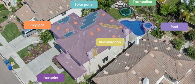
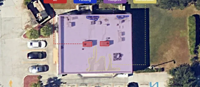
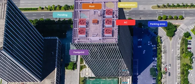
Condition (proprietary 6-point scale), material, type, rust area, ponding area, discoloration area, tarp evidence, flat area, hip area, solar panel area, air conditioner count.
-
3D data
Building height, minimum ground height, number of stories, commercial square footage - measured directly from aerial imagery, filling gaps where tax records fail.
-
Vegetation & defensible space
Tree overhang, distance to tree, distance to vegetation, tree density, shrub density, vegetation density, defensible space assessment.
-
environment & exposure
Distance to coast, distance to water body, distance to fire station, distance to nearest building.
-
Parcel data
Pool count, pool enclosure count, temporary pool count, trampoline, number of buildings in parcel, parcel ID.
Roof condition. Scored, dated, and explained.
Spot risky roofs before they become claims. Each roof gets a simple 0 to 100 condition score, with the visible evidence behind it and the date of the image, so your team can act with confidence and defend every decision.
Each score is traceable to specific visual evidence: rust, ponding, discoloration, and tarp.
Underwriters can see exactly why a property was flagged. No unexplained numbers. No algorithmic opacity.
-
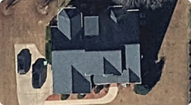
Excellent
No visible defects. Roof in optimal condition.
-
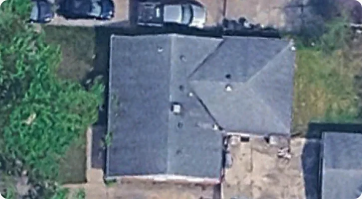
Good
Minor wear consistent with age. No action required.
-
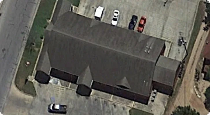
Fair
Early signs of deterioration. Monitor at renewal.
-
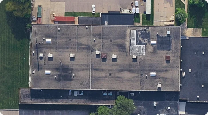
Poor
Significant deterioration. Pricing adjustment recommended.
-
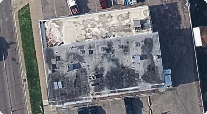
Bad
Major defects present. Inspection or remediation required.
-
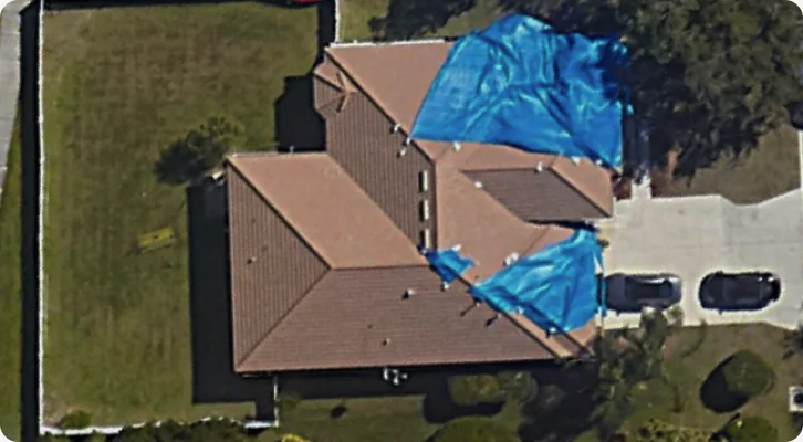
Damaged
Structural compromise evident. Immediate action needed.
Evidence types: Rust · Ponding · Discoloration · Tarp
One database. Every workflow.
-
Underwriting - Point of Quote
Analyze every property before you price it. Every address. Every state. Instant access at quote time because the data is pre-processed.
-
Portfolio Assessment
Review concentration risk across your book, including vegetation density, distance to fire station, coastal exposure, and building proximity, all pre-calculated for every matched address.
-
Inspection Replacement
Replace costly physical inspections with aerial-derived property intelligence. Roof condition, vegetation clearance, structural attributes - assessed without sending an inspector. Updated quarterly, which is more current than most inspection programs.
-
Renewal & Change Detection
Compare dated imagery across policy periods to spot roofs whose condition may have changed before renewal.
Access the data the way your team works best.
-
Real-time API
Sub-second response for point-of-quote decisions. RESTful. Documented. Production-ready.
-
Batch delivery
CSV/GeoPackage for portfolio-wide analysis. Integrates with existing analytics pipelines and CAT models.
-
Platform access
Visual property exploration with historical imagery timeline, condition overlays, and report generation.
How we build the database.
-
Imagery Sources
High-resolution aerial and satellite imagery across all 50 US states. Where available, multiple imagery dates per property support change and trend analysis.
-
AI/ML Processing
Proprietary computer vision models extract 64+ attributes per property and are improved release by release.
-
Quarterly Refresh
The database is refreshed quarterly with new imagery, ensuring that risk decisions are grounded in current reality - not stale snapshots from years ago
-
Validation
Every score is evidence-backed. Condition assessments are traceable to specific visual indicators. No black boxes. No unexplained outputs.
Trusted by:






-
53.2%
of US buildings carry at least one risk flag
-
168.2M
buildings have vegetation within 5 ft
Testing GeoX AI against another vendor showed a clear accuracy advantage, giving us the validation to move forward.

186 million properties. Already processed. Ready now.
No coverage gaps. No on-demand delays. No black-box scores. Just structured, evidence-backed property intelligence for every address in the US.
Frequently asked questions.
What is a US property database?
A US property database is a structured dataset that describes physical, structural, and risk-related characteristics of properties - such as roof condition, building footprint, vegetation proximity, and coastal exposure - for use in underwriting, portfolio analysis, and risk pricing. The GeoX AI USDB covers 186.2 million properties across all 50 states with 64+ attributes per property.
How is property data collected for the USDB?
GeoX AI derives attributes from high-resolution aerial and satellite imagery using proprietary computer vision models, rather than from self-reported applications or tax records. Every property is pre-processed, so attributes are available instantly rather than generated on demand.
How current is the USDB?
The database is refreshed quarterly with new imagery, so risk decisions are based on current property conditions rather than outdated records.
What makes GeoX AI's property intelligence different from other providers?
Two things: the database is pre-processed rather than on-demand, so results return in under a second; and every condition score is evidence-backed, meaning it's traceable to specific visual indicators (rust, ponding, discoloration, tarp) rather than an unexplained model output.